Satellite Eye on Earth: May 2017 in pictures

Vesuvius in Italy and volcanoes in northern Tanzania, lights going out in Syria, and flooding in Sri Lanka are among images captured by Nasa and the ESA this month.
A vertical view of Vesuvius in southern Italy, taken by the European Space Agency (ESA) astronaut Thomas Pesquet from the International Space Station. The Proxima mission is named after the closest star to the sun, continuing a tradition of naming missions with French astronauts after stars and constellations. The mission is part of the ESAs plan to use Earth-orbiting spacecraft as a place to live and work while preparing for future voyages of exploration further into the solar system.
Photograph: OLI/Landsat 8/Nasa
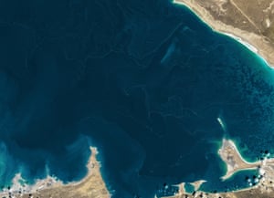
The next time you are out at sea, keep an eye out for long filaments of foam and debris floating on the surface. This common phenomenon usually the product of natural decomposition processes and wind is seen on Garabogazkl, a shallow, salty lagoon near the Caspian Sea in Turkmenistan. In most cases, foam is the product of decaying aquatic plants, algae, phytoplankton, or other microorganisms. The decomposition process releases oils and other substances called surfactants that rise up and reduce the surface tension of the water, making it easier for bubbles to form in windy conditions. (In addition to these natural sources, detergents and other manmade pollutants can act as surfactants.) In the case of Garabogazkl, the white lines are likely the intersections of warmer and cooler waters. When two surface currents bump into each other, they dive.
Photograph: ISS/Nasa/ESA
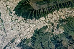
Mount Silla also referred to as Cerro de la Silla or Saddle Hill is an iconic landscape feature of the Monterrey, the capital of the Mexican state of Nuevo Len. When viewed from the west, the ridges and peaks resemble a saddle. Mount Silla has been declared a natural monument under the guidelines of the World Commission on Protected Areas. The Monterrey metropolitan area sits 1,300 meters (4,200 feet) below the steep, forested flanks of the mountain. Monterrey straddles several large rivers flowing out of the mountains. The Santa Catarina river cuts through the older parts of the city (such as Monterrey Antiguo). Major highways follow the river to the nearby cities of Guadalupe, San Pedro Garza, and Santa Catarina. Rio La Silla (Saddle river) flows from the northern Sierra Madre Oriental mountain range and joins the Santa Catarina just outside the top left corner of the image. The semi-arid climate keeps these rivers dry for much of the year. Nuevo Len state is home to the third largest economy in Mexico thanks to Monterreys extensive manufacturing facilities and infrastructure.
Flooding along the Mississippi, Missouri, and Illinois rivers. At the time, the Mississippi was transitioning from moderate to minor flood stage. For comparison, the first image shows the three rivers a year earlier.
Photograph: OLI/Landsat 8/Nasa
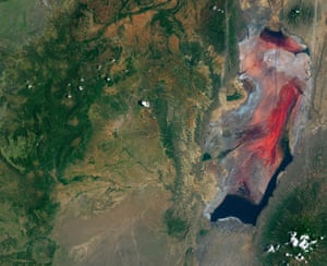
Not many people venture near the shores of Lake Natron in northern Tanzania. The lake is mostly inhospitable, except for a few species adapted to its warm, salty, and alkaline water. The lake is seen here very early in the rainy season that runs from March to May. The climate here is arid. In a non-El Nio year, the lake receives less than 500mm (20in) of rain. Evaporation usually exceeds that amount, so the lake relies on other sources such as the Ewaso Ngiro river at the north end to maintain a supply of water through the dry season.
[AdSense-A]
But it is the regions volcanism that leads to the lakes unusual chemistry. Volcanoes, such as Ol Doinyo Lengai (about 20km to the south), produce molten mixtures of sodium carbonate and calcium carbonate salts. The mixture moves through the ground via a system of faults and wells up in more than 20 hot springs that ultimately empty into the lake. While the environment is too harsh for most common types of life, there are some species that take advantage of it. Small, salty pools of water can fill with blooms of haloarchaea salt-loving microorganisms that impart the pink and red colours to the shallow water. And when the waters recede during the dry season, flamingos favour the area as a nesting site as it is mostly protected from predators by the perennial moat-like channels and pools of water.

Photograph: ISS/Nasa/ESA
Drainage patterns are visible on the south-western end of the Gobi desert in Chinas Gansu province. The desert landscape part of the Hexi corridor along the historical Silk Road is low in elevation, generally flat, and surrounded by mountains and rolling hills. The foothills of the Tien Shan mountains lie to the north. As temperatures warm in the spring, snow melt from the higher elevations flows down into streams, forming narrow alluvial fans. The water carries sand, silt, and clay that accumulate at the mouths of the streams. These sediments are then available for further transport by larger valley rivers such as the Shule. The grid pattern superimposed on the basin is part of the Gansu wind farm project. Narrow roads mark the paths between dozens of wind turbines. Currently China is the largest emitter of greenhouse gases, and the wind farms are part of an effort to reduce carbon emissions and to harness cleaner energy. Several small towns skirt the Shule river, diverting water for cultivation of wool, tobacco, and a variety of grain and fruit crops.
Photograph: VIIRS/Suomi NPP/Nasa
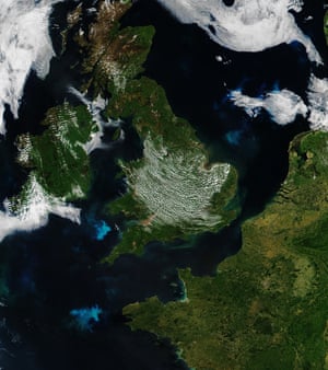
Phytoplankton blooms in the waters around Britain and France. Increasing sunlight in the spring provides the energy for the floating, microscopic plant-like organisms to bloom in vast numbers.
These images show differences in night-time lighting between 2012 and 2016 in Syria and Iraq, among several Middle Eastern countries. Such images can indicate economic development or the lack of it. Some changes reflect increases or decreases in electric power generation or in the steadiness of the supply.
Night light images also have value for international relief and humanitarian organisations, which can use this data to pinpoint areas in need. Nasa makes its Earth observations openly available to those seeking solutions to important global issues.
In the above images, the changes are most dramatic around Aleppo, but also extend through western Syria to Damascus. Over the four years, lighting increased in areas north of the Syrian border in Turkey and to the west in Lebanon. According to a 2015 report from the Voice of America, as much as 80 percent of the lights have gone out in Syria over the past few years.
In Iraq, some northern sections near Mosul saw a decrease in light, while areas around Baghdad, Irbil, and Kirkuk saw increases. Note, too, the change in electric light patterns along the Tigris and Euphrates river basins.
Photograph: Modis/Terra/Nasa
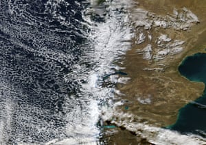
By late autumn the temperatures in southern South America begin to turn chilly and grasses develop the first traces of the brown colouration of senescence as they start to wilt and dry. It is also the time when precipitation increases as the season heads into winter. A broad bank of open-celled marine cumulus clouds covers the South Pacific. Thick clouds also hang over the Andes, obscuring all of Chile (along the west coast) and much of western Argentina. Smaller clumps of cloud are scattered across the semi-desert of Argentina some reaching over the Argentine Sea.
Photograph: Proba-V/Vito/ESA
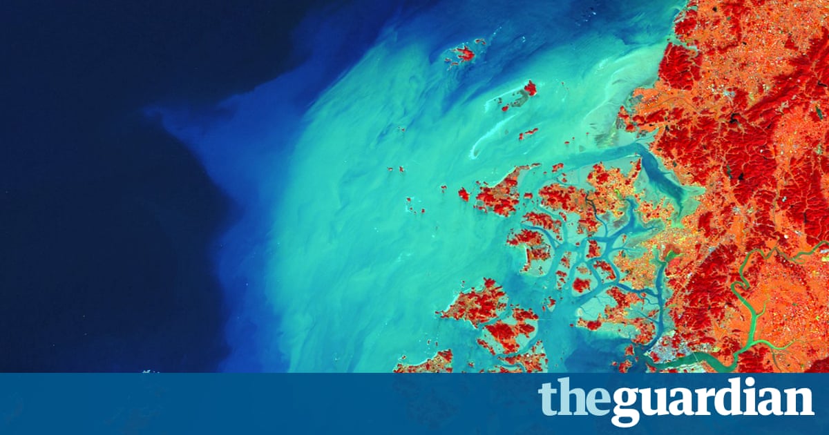
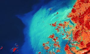
Mokpo is a city of 250,000 inhabitants in the south-west of South Korea. It is a main gate to the countrys largest granary at the Honam plain and was a naval base during the Joseon dynasty (13921910). The port city is surrounded outside the coast by more than 1,400 islands, which provide fishing grounds and also protect the area from large typhoon and tsunami impacts. Mokpo lies in the bottom right of the image, a blue-grey area located at the Yeonsang river estuary. Scattered smaller and larger islands lie off the coast, while an extensive area with large sediment concentrations extends further into the Yellow Sea in a bow shape.
The Arctic is largely hemmed in by the northern edges of Eurasia and North America. As a result, pieces of drifting pack ice have few outlets for escape when sea ice is thinning and breaking up in the spring and summer.
The primary passageway out of the Arctic is the Fram Strait between Greenland and Svalbard. However, a narrower waterway to the west the Nares Strait, which separates Greenland and Ellesmere Island is also important. The amount of ice flowing through the Nares Strait in 2017 will likely be higher than usual. A key arch of pack ice that blocks other pieces of ice from entering the strait has broken apart earlier than usual. Typically, ice arches form between Ellesmere Island and Greenland in January and break down in early July. In 2017, sensors on Nasa satellites observed a key arch breaking down in mid-May. By May 12, large pieces of sea ice had begun to break into slivers and move into the strait. By May 17, even more pack ice north of the arch had broken up.
That is not good news because an unusually warm winter means that the overall extent of Arctic sea ice between January and May 2017 had already shrunk well below the 1981-2010 median.
Early breaks of ice arches have happened in this area before. In 2007, unusually warm winter weather prevented this ice arch from forming at all. That doubled the amount of ice that flowed through the strait that year compared to the average, according to an analysis of satellite data led by Ronald Kwok of the Jet Propulsion Laboratory. While that doubling was significant, the total flow of ice through the Nares Strait that year was still just 10% of what regularly passes through the larger Fram Strait.
Photograph: ISS/Nasa/ESA
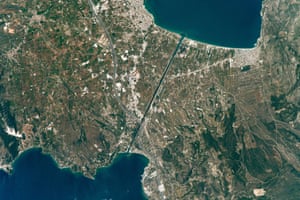
The straight line in the centre of the image is the Corinth canal as it crosses a narrow isthmus between mainland Greece (right) and the Peloponnese peninsula. The towns of Corinth and Isthmia stand near the west and east ends. A highway crosses the canal and connects Athens to the Peloponnese. Twenty-six hundred years ago, the ruler of Corinth Periander proposed digging a canal to connect the Mediterranean (via the Gulf of Corinth) to the Aegean (via the Saronic Gulf). The goal was to save ships from the dangerous 700km voyage around the ragged coastline of the peninsula. But the canal was still too ambitious a digging project and construction was not started.
Not Julius Caesar, nor the Roman emperors Caligula or Nero, were able to complete their plans for this ambitious project. The Venetians laid plans to dig the canal in the late 1600s but they never started it. In lieu of a water passage, boats have been hauled overland for centuries on a portage created by Periander. It runs roughly along the line of the modern canal. Construction of the modern Corinth canal which is 6.4km long (4 miles) was started in 1882 and completed by 1893. The canal is narrow (only 21.3 metres), making many ships too wide for it. Landslides from the steep walls have occasionally blocked the canal, while channeled winds and tides can also make navigation difficult.
Photograph: Modis/Aqua/Nasa
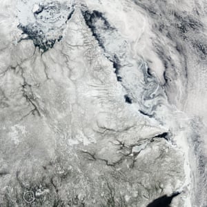
With the onset of spring and warmer temperatures in the Northern Hemisphere, sea ice is thinning and breaking up along Canadas Labrador coast. On 13 May 2017, a combination of winds and currents steered the ice into the interlocking swirls.
Torrential rains caused severe flooding in Sri Lanka in late May 2017. After more than 48 hours of non-stop rain, water levels rose rapidly in the countrys south, spurring emergency evacuations in multiple districts. An earlier image taken in January 2017, shows the same area before the waters rose.
Matara was among the hardest hit towns. Low-lying areas around the Nilwala Ganga river (in blue) have also been submerged. In many areas, flooding has contaminated wells and tainted water supplies. Sri Lankas disaster management centre reported that more than half a million people have been affected by the flooding.
Photograph: Copernicus Sentinel-2A/ESA
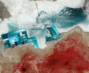
A seasonal salt marsh known as the Rann of Kutch in western India is one of the largest salt deserts in the world.
Read more: https://www.theguardian.com/environment/2017/jun/14/satellite-eye-on-earth-may-2017-in-pictures